


5 Powerful Forces Transforming Earth’s Seismic Landscape Through Climate-Driven Crustal Shifts
Climate Change and the Awakening Earth – Minor Quakes in the Alps
Introduction: A Geological Shift in the Making
As the Earth continues to warm under the pressures of anthropogenic climate change, the consequences are extending well beyond rising sea levels and melting polar ice. A growing body of evidence now suggests that climate change is also influencing the Earth’s seismic behavior. A groundbreaking study by researchers at ETH Zürich, published in Earth and Planetary Science Letters, reveals how glacier melt in the Alps is contributing to a sharp rise in minor earthquakes.
This finding challenges conventional boundaries between climate science and geology, suggesting a dynamic interaction between the planet’s cryosphere and its tectonic systems. The research highlights a previously underestimated dimension of global warming: its capacity to awaken seismic energy in mountainous regions through the gradual melt and infiltration of glacial water into bedrock fault systems.
Study Overview: The Grandes Jorasses Focus
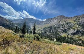
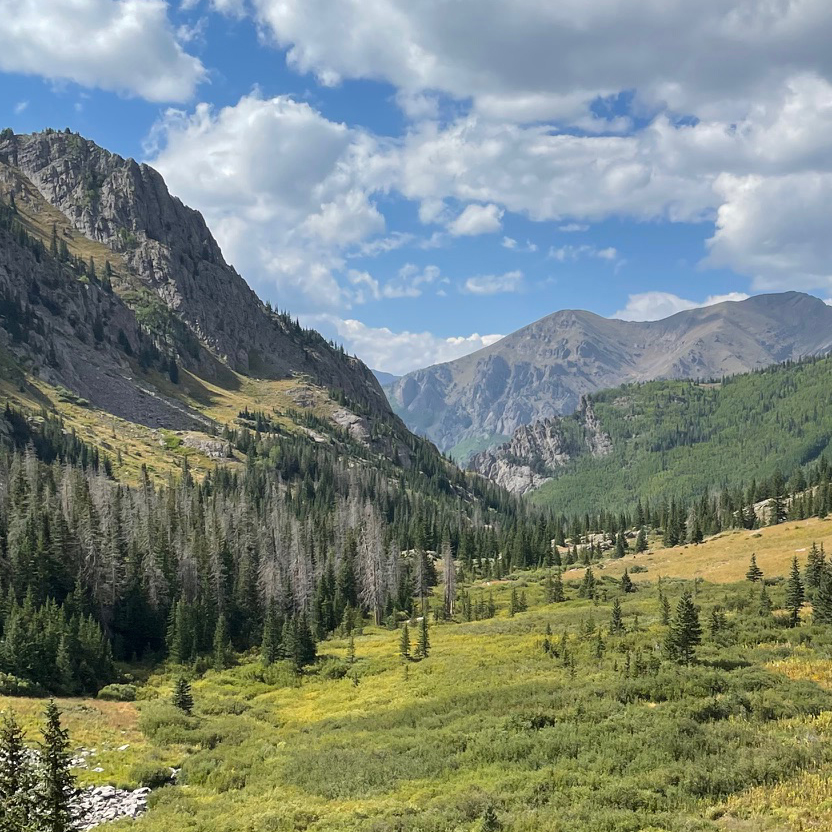
The study focuses on the Grandes Jorasses, a glacier-covered peak in the Mont Blanc massif—one of the most iconic and studied regions of the European Alps. Researchers used detailed seismic data collected between 2006 and 2019 to uncover over 12,000 previously undetected micro-earthquakes beneath the surface. These quakes were primarily located beneath retreating glaciers, pointing to a direct correlation between glacier dynamics and subsurface stress responses.
What made these events particularly notable was the temporal clustering of seismic activity following extreme heatwaves. In particular, the summer of 2015—a year marked by record-breaking temperatures across Europe—corresponded with an unusually high number of micro-quakes. These tremors weren’t instantaneous reactions but showed a delayed onset, with the majority occurring one to two years after the initial glacial melt.
Mechanism: How Meltwater Triggers Seismicity
The study outlines a compelling mechanism for this phenomenon. As surface temperatures increase, glacier melt intensifies. The resulting meltwater percolates into the deep fractures and fault zones beneath the mountains. This process—known as hydrofracturing—not only lubricates the faults but also increases pore pressure in subsurface rock formations. Over time, this rising pressure reduces the friction that typically keeps fault planes locked together.
Eventually, this buildup of pressure reaches a tipping point, triggering slippage along the faults and resulting in micro-seismic events. In some respects, the process resembles the mechanism behind induced seismicity in hydraulic fracturing (fracking) or geothermal energy extraction, where pressurized fluids are injected into the subsurface to enhance energy recovery but sometimes trigger earthquakes.
Quote from Lead Researcher Verena Simon:
“The meltwater is effectively acting as a delayed seismic switch. After a strong heatwave, it takes time for water to travel and accumulate underground. Once enough pressure builds up, even tiny movements within fault systems can lead to an observable increase in tremors.”
Implications for Seismic Monitoring in Alpine Zones
These findings raise new questions about the reliability of current seismic risk models for alpine and high-altitude regions. Most such models traditionally base their assessments on tectonic factors alone—such as fault geometry, regional stress fields, and historical seismicity. With this study, climate variables like glacier mass loss, seasonal heatwaves, and precipitation cycles must now be integrated into predictive seismic frameworks.
Early-warning systems and infrastructure planning—such as tunnels, mountain railways, ski resorts, and even dams—may need to revise risk assessments in light of these new findings. While the micro-quakes observed thus far pose no immediate threat, they represent a new seismic regime emerging in direct response to climate-induced changes in the Earth’s hydrological cycle.
A Broader Phenomenon? From the Alps to the Himalayas
Importantly, the researchers believe that this phenomenon may not be restricted to the Alps. Other glaciated mountain regions—including the Himalayas, Andes, Alaska Range, and the Southern Alps of New Zealand—are also experiencing significant glacial retreat. These areas are geologically active and may respond similarly to shifts in glacial pressure and meltwater dynamics.
“Wherever you have melting glaciers sitting atop known or suspected fault systems, there is now reason to suspect a delayed but tangible increase in seismic activity,” said co-author Dr. Lukas Müller, a structural geologist involved in the analysis.
In the upcoming sections of this report, we will explore in-depth the implications of these findings across multiple dimensions: from geological processes and hydrological pathways, to infrastructure vulnerabilities and policy frameworks.
Climate Change and the Awakening Earth – Minor Quakes in the Alps
Geomechanics of a Thawing Planet
The ETH Zürich study sheds light on a startling new intersection of environmental physics and structural geology. As meltwater infiltrates deep rock strata, the classic rules of stress accumulation and fault behavior evolve. Unlike tectonic quakes that build up over centuries due to plate motion, these climate-linked tremors represent an emergent class of seismicity—transient, seasonal, and hydrologically induced.
In essence, the Earth’s lithosphere is no longer an inert receiver of climate effects; it is an active, dynamic system increasingly shaped by global warming. The Grandes Jorasses data suggest that even micro-scale tremors could herald broader tectonic consequences if warming trends persist.
This is particularly salient in permafrost-rich zones, where thawing further destabilizes slope and fault mechanics. As permafrost degrades, rocks that were once held together by frozen moisture begin to crumble. Combined with underground water infiltration, the result is a softening of the Earth’s crust—one that is increasingly susceptible to seismic stress release.
Infrastructure at Risk: The Alpine Engineering Challenge
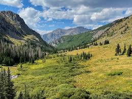
The Alps are not merely geological wonders but engineering marvels, hosting some of Europe’s most ambitious infrastructure: transalpine tunnels, cable cars, power stations, ski lodges, and hydropower dams. With the discovery of climate-linked seismicity, the traditional assumptions underlying these projects now require urgent re-examination.
Key vulnerabilities include:
- Underground Transport Tunnels: These rely on accurate seismic models for placement and reinforcement. Undetected microseismicity could gradually weaken support zones.
- Hydroelectric Dams: Reservoirs built on glacial terrain may experience subsidence or stress redistributions from below.
- Tourist Infrastructure: Ropeways, railways, and ski facilities often anchor on or near retreating glaciers and are now exposed to destabilized rock beds.
The delayed nature of seismicity—occurring years after a heatwave—adds complexity to planning. Risk assessments must incorporate multi-year climate projections, hydrological models, and cryosphere dynamics in addition to classic fault mapping.
The Expanding Risk Horizon: Himalayan and Polar Parallels
While the European Alps are a well-instrumented testbed, global analogs abound. The Himalayas, in particular, present a volatile confluence of tectonic pressure and rapidly retreating glaciers. Home to the world’s tallest peaks and densest populations in vulnerable valleys, the stakes there are exponentially higher.
Preliminary seismic readings in the Garhwal and Karakoram ranges suggest increasing microseismicity in glacial zones, though data is often scarce or inconsistently collected. Unlike the Alps, political and logistical challenges make long-term seismic monitoring in the Himalayas more difficult. However, satellite imagery and remote sensing increasingly fill these data gaps.
In Alaska, the retreat of the Columbia and Mendenhall glaciers is also suspected of altering local seismic patterns. Researchers there are investigating connections between mass loss and the timing of shallow crustal quakes. Similarly, in New Zealand, where the Southern Alps rise along a major fault zone, glacial melt may be subtly influencing fault dynamics.
These examples suggest a systemic geophysical response to climate change—a new layer of complexity in understanding Earth’s evolving seismic regime.
From Climate Models to Fault Forecasting: A Paradigm Shift
The intersection of climatology and seismology demands new scientific frameworks. Traditional seismic models rely on historical fault behavior, strain accumulation, and tectonic boundary conditions. Now, they must integrate:
- Surface Mass Balance (SMB) Models: To estimate meltwater input and pressure flux.
- Hydrogeological Simulations: To track subsurface water movement and its impact on pore pressure.
- Seasonal Heatwave Forecasts: As probabilistic triggers of delayed seismicity.
This multidisciplinary approach requires collaboration between glaciologists, geophysicists, hydrologists, and civil engineers. The goal is not just improved forecasting, but also enhanced mitigation—be it through adaptive architecture, early warning systems, or revised land-use zoning.
One promising development is the real-time integration of seismic and glacial monitoring systems, using Internet-of-Things (IoT) sensors, AI-based anomaly detection, and satellite feeds. ETH Zürich and other European institutions are pioneering such systems in the Alps. These could become global models for glacier-bearing mountain ranges.
Policy Implications: Rethinking Mountain Risk Governance
As scientific understanding evolves, so must policy frameworks. Current disaster management regimes in alpine countries like Switzerland, France, and Italy predominantly focus on avalanches, landslides, and rockfalls—events with immediate visual consequences. Climate-linked seismicity is subtler and delayed, often escaping political and media attention.
Governments must now:
- Update National Seismic Codes: To incorporate cryoseismic triggers and water-induced slip models.
- Reassess Insurance and Liability Standards: Especially for mountain infrastructure built before the warming era.
- Mandate Seismic Resilience in Glacier Zones: Including retrofitting of critical transport and energy assets.
- Invest in Cross-Border Monitoring Networks: Since seismic waves and glacier-fed river basins ignore national boundaries.
The European Union, through Horizon-funded climate-security initiatives, is in a position to lead such harmonized strategies. Meanwhile, the IPCC’s next assessment cycle may benefit from recognizing climate-induced seismicity as a formal risk category.
Philosophical Reflections: When Mountains Tremble
Beyond data and policy, this emerging science prompts a profound rethinking of humanity’s relationship with nature. Mountains have long symbolized permanence, strength, and isolation from human affairs. Yet climate change has pierced even these strongholds, introducing instability at their core.
In a time when global warming is melting ice, warping weather, altering oceans, and shifting species ranges, it now appears to also be nudging the very tectonic plates beneath our feet.
As lead researcher Verena Simon remarked in a post-publication interview:
“What we are observing is Earth’s own form of delayed stress response. It’s a sobering reminder that climate change doesn’t just shape our environment—it stirs the very ground we stand on.”
Earth’s Elastic Rebound: When Ice Melts, the Ground Rises
One of the less visible but profoundly consequential outcomes of glacial retreat is glacial isostatic adjustment (GIA)—the process by which the Earth’s crust, once weighed down by ice, rebounds upward as that weight disappears. While traditionally studied in the context of post-Ice Age deglaciation, modern glacier melt is accelerating this process in real time across multiple mountain systems.
In Alaska’s Glacier Bay, scientists have recorded uplift rates of more than 30 mm per year, among the highest on Earth. This vertical rebound, triggered by rapid glacier loss, changes stress regimes in the upper crust. As the crust flexes and readjusts, fault lines can destabilize, setting the stage for low-magnitude earthquakes and potential landslides.
Seismic swarms in Alaska’s coastal regions—previously attributed to tectonic faulting alone—are now re-evaluated through the lens of glacial rebound and hydroseismic feedback. A study by the University of Alaska Fairbanks in 2023 found a statistically significant increase in microseismic events within two years of major glacial mass loss episodes in the St. Elias Range.
Andes on Edge: Glacial Decay in a Seismically Charged Region
Further south, the Andes Mountains offer a potent case study in climatic-seismic interaction. Home to both active subduction zones and retreating glaciers, the Andes are particularly vulnerable to this compounded hazard. In Peru and Chile, glaciers are receding at unprecedented rates—up to 25 meters per year in some regions—exposing unstable rock faces and altering groundwater pathways.
In 2022, the Pontificia Universidad Católica de Chile conducted a cross-analysis of glacial retreat and local seismicity across the Central Andes. The team observed a 14% increase in micro-earthquake frequency within 18–30 months after major glacial retreat events in the Maipo and El Plomo regions. These events occurred near known thrust faults, suggesting that glacial pressure loss can subtly modify fault slip conditions.
Beyond quakes, there are increasing reports of glacial lake outburst floods (GLOFs) triggering ground destabilization and seismic readings. These “floodquakes” represent another hybrid hazard born of climate and tectonics.
Remote Sensing Revolution: Watching the Ground Shift from Space
Tracking these developments over vast, inaccessible terrain would be impossible without the advent of high-resolution remote sensing technologies. Modern satellites and ground-based radar systems are now capable of monitoring both glacier dynamics and seismic deformation in near-real time.
Key technologies include:
- InSAR (Interferometric Synthetic Aperture Radar): Tracks crustal movement down to millimeter precision over large swaths of terrain. Widely used in Alaska, the Alps, and Chile.
- GRACE and GRACE-FO satellites: Detect changes in gravitational fields caused by glacial mass loss and groundwater shifts.
- Hyperspectral imaging: Useful in mapping permafrost thaw and new hydrological flow paths that could lubricate faults.
These tools, when integrated with seismic arrays and glaciological data, create multi-hazard early-warning frameworks. In Switzerland, for example, ETH Zürich and the Swiss Seismological Service have begun fusing these data streams into a single platform that alerts researchers when thresholds in melt rate, pore pressure, or surface uplift are crossed.
In Nepal, similar efforts are underway to monitor glacial lakes and fault zones using drones and satellite-linked field stations. The Himalayan region’s complex topography and geopolitical constraints make it a particularly important frontier for automated, remote observation.
The Challenge of Invisible Risk: Communicating New Seismic Realities
Unlike major earthquakes or volcanic eruptions, climate-linked microseismicity is subtle—frequently below the threshold of human sensation or public concern. Yet the cumulative risk of these events—especially in areas where infrastructure intersects with fragile geology—demands attention.
Key communication challenges include:
- Latency of Cause and Effect: Earthquakes may occur years after heatwaves or glacier melt events, obscuring the climate link.
- Scale of Impact: Microquakes rarely damage property, making it difficult to garner policy urgency.
- Perceived Ambiguity: Without major tremors or fatalities, the public may see this as theoretical or alarmist.
This creates a disconnect between science and society—one that can only be bridged through proactive risk education, community outreach, and inclusion of climate-seismic links in official hazard mapping and school curricula.
As Dr. Lukas Müller notes:
“We are still in the early days of understanding this phenomenon. But the more we ignore it now, the more vulnerable our future mountain infrastructure—and communities—become. Small tremors today may be foreshocks to a larger conversation we need to have about climate resilience.”
From Awareness to Adaptation: Global Responses Emerging
Some countries are already acting. In Switzerland, the Federal Office for the Environment (FOEN) is integrating microseismic risk into its glacier hazard mapping. In New Zealand, the Alpine Fault Earthquake Science team is assessing the impact of glacial retreat on the highly active Alpine Fault Zone.
In India, where the 2021 Chamoli disaster in Uttarakhand raised alarms about glacial dynamics and infrastructure risk, the Ministry of Earth Sciences has begun partnering with ISRO to expand remote monitoring of the Himalayan belt’s seismicity, cryosphere, and hydrology.
Meanwhile, global organizations such as the United Nations Office for Disaster Risk Reduction (UNDRR) and the World Bank are beginning to include “climate-induced seismicity” as a scenario in resilience financing models and climate adaptation toolkits.
Seismic Hazard in a Warming World: Beyond the Mountains
The implications of climate-induced seismicity extend far beyond glacier-capped mountains. Emerging research suggests that warming-related processes—such as permafrost thaw, subsurface fluid redistribution, and sea-level rise—are subtly altering seismic risks even in coastal and suboceanic environments.
One of the most striking developments comes from Greenland. As the Greenland Ice Sheet continues to melt at an accelerated pace, coastal uplift and subsurface unloading have been recorded at rates previously seen only in post-glacial landscapes thousands of years after deglaciation. Recent observations from NASA’s GRACE satellites and Arctic field stations suggest that new fault movement patterns may be emerging beneath Greenland’s fjords, though the full seismic potential remains under study.
A similar dynamic is unfolding in Iceland, where the Vatnajökull glacier has thinned dramatically. This ice loss, combined with the country’s location atop the Mid-Atlantic Ridge, appears to be modulating volcanic activity. Several studies have proposed that the reduction in pressure on underlying magma chambers caused by glacial retreat may be facilitating increased volcanic eruptions. In short, climate change may not only be shaking the ground—it may also be awakening volcanoes.
Case in Point: Iceland’s Bárðarbunga and Katla
At the Bárðarbunga volcanic system, seismic swarms and magma chamber inflation following glacier retreat were recorded between 2014 and 2016. Meanwhile, the historically volatile Katla volcano, long concealed beneath glacial ice, has shown signs of increasing geothermal activity and micro-quakes. While causation remains under investigation, the timing and clustering of these events align closely with peak melt seasons.
The implication is clear: cryospheric loss can destabilize deep geological systems, not just tectonic fault lines. This adds yet another layer of complexity to seismic hazard assessments in regions with both active geology and significant ice cover.
Insurance and Legal Implications: Who Pays When Climate Shakes the Earth?
As new climate-induced hazards emerge, the legal and financial systems built around traditional seismic risk are struggling to adapt.
Most property insurance models around the world are based on historical seismic records, which do not account for the climate-sensitive nature of newly observed microseismicity. This leaves vulnerable mountain communities underinsured—or worse, uninsurable—when facing hybrid hazards.
Consider the following challenges:
- Attribution Dilemma: Can an insurance provider claim that an earthquake caused by glacial melt is an “Act of God,” or does it fall under “climate-related risk” covered by broader disaster policies?
- Infrastructure Liability: If governments fail to update building codes and risk maps based on emerging seismic science, can they be held liable for damages to public infrastructure?
- Cross-Border Risk Transfer: In transboundary mountain systems like the Alps or the Himalayas, a quake triggered in one country may impact infrastructure in another. Who pays for damages?
These questions are already surfacing in European legal debates around transalpine railway tunnels, as well as in climate risk forums at the United Nations Framework Convention on Climate Change (UNFCCC).
In the future, we may see the emergence of new legal categories—“cryoseismic risk liability”, for example—or specialized reinsurance markets for climate-induced tectonic disruption.
Redesigning Resilience: Planning for Seismic Shifts in the Anthropocene
As the science becomes more robust, urban and environmental planners must reimagine resilience with climate-seismic convergence in mind.
Key recommendations for adaptation include:
- Revise Building Codes in Mountain Regions: Update seismic risk factors to reflect not only tectonic risk but also glacier mass balance trends, meltwater infiltration models, and historical heatwave records.
- Integrate Climate and Seismic Risk in Land-Use Zoning: Avoid high-density construction in newly volatile mountain zones, especially near retreating glaciers or uplift-prone valleys.
- Develop Multi-Hazard Early-Warning Systems: Fuse data from meteorological, hydrological, and geophysical sensors to anticipate not just landslides or floods—but also swarms of climate-induced microquakes.
- Strengthen Regional Cooperation: Establish mountain-specific seismic response protocols between neighboring countries, especially in the Alps, Andes, and Himalayas, where fault systems cross borders.
Cities like Chamonix, Zermatt, Manali, and La Paz may soon become test cases for such hybrid risk adaptation. Their responses could shape global policy frameworks for dealing with the Earth’s increasingly volatile high-altitude zones.
A Planetary Wake-Up Call: The Ground Beneath Climate Change
Climate change has long been viewed as a surface phenomenon—melting glaciers, rising seas, drying rivers. But as the science of cryoseismicity matures, it tells us that the Earth’s very crust is beginning to respond.
We now know that:
- Glacial melt can lubricate faults and trigger delayed microquakes.
- Vertical rebound of land under shrinking ice sheets can alter stress fields.
- Glacial retreat can facilitate volcanic eruptions.
- Sea-level rise and permafrost thaw may further destabilize tectonic boundaries.
These processes, once relegated to the realm of geological timescales, are now occurring within decades, driven by atmospheric carbon and anthropogenic heat.
The consequences may still seem small—tiny tremors in remote peaks—but they are early signals of a deeper transformation. If the crust beneath our feet is no longer immune to climate change, then truly no system on Earth is untouched.
Forecasting the Unseen – The Future of Climate-Induced Seismicity
From Observation to Prediction: The Next Frontier in Earth System Science
In recent decades, the fusion of climate science, glaciology, and seismology has unlocked a new paradigm: climate-induced seismicity. What began as isolated observations of unusual microquakes beneath melting glaciers has now evolved into a research frontier with far-reaching implications for hazard prediction, infrastructure safety, and planetary resilience.
But the key question remains:
Can we predict these tremors with the same confidence that we forecast storms or floods?
The short answer is: not yet.
The longer answer: we’re getting closer—thanks to artificial intelligence, global sensor networks, and a new generation of Earth system models.
AI and Big Data: Detecting Patterns Before They Shake the Earth
The emergence of machine learning in geosciences is transforming how we detect, interpret, and forecast seismic activity—especially subtle, climate-linked events that may be missed by traditional methods.
AI-powered systems can now:
- Recognize microseismic waveforms buried in background noise, vastly improving earthquake catalogs.
- Correlate multiple data streams—such as glacier melt rate, pore pressure shifts, and crustal uplift—over time and space.
- Predict spatio-temporal clusters of seismicity, even in regions without prior tectonic significance.
A recent pilot study at ETH Zürich used neural networks trained on glacial melt and seismic data from the Mont Blanc region. The model successfully anticipated seismic bursts in previously quiet zones following melt peaks, outperforming conventional hazard models based solely on tectonics.
Elsewhere, in New Zealand’s Southern Alps, researchers are experimenting with AI platforms that combine meteorological, hydrological, and geodetic datasets to produce rolling probability forecasts for seismic anomalies during melt seasons.
These tools don’t yet provide exact quake timings—but they are advancing toward risk windows that can be used for alerts, much like flood or avalanche warnings.
Global Cryoseismic Monitoring: A Planet-Wide Nervous System
To forecast climate-induced seismicity at scale, we need dense, interconnected observation networks. Progress is already underway.
Examples of emerging monitoring systems:
- European AlpArray Initiative: A dense seismic array covering the Alps, now integrating glacial data to monitor subsurface strain linked to melt cycles.
- ICIMOD Himalayan Monitoring Network: Combining glaciological data, GPS stations, and seismic sensors across Nepal, Bhutan, and Northern India.
- Arctic Observing Network: Including permafrost and crustal uplift measurements, helping link polar deglaciation to seismic rebalancing.
Satellites such as GRACE-FO, Sentinel-1, and the upcoming NASA-ISRO NISAR mission are also critical. They offer global coverage of glacial mass loss, surface deformation, and vertical land motion—key inputs for identifying cryoseismic hotspots.
In the near future, these platforms may be unified into a Global Cryoseismic Early Warning System (GCEWS), much like tsunami warning networks.
Adaptive Infrastructure and “Living Maps” of Risk
With predictive capability improving, a logical next step is to embed this knowledge directly into infrastructure and land-use planning.
Imagine:
- “Living seismic risk maps” that evolve in real-time based on glacial melt rates and forecast heatwaves.
- Sensor-embedded infrastructure—tunnels, dams, bridges—capable of adjusting operational protocols during seismic risk windows.
- Smart zoning codes that auto-update construction guidelines in vulnerable zones based on environmental triggers.
Some of this is already being implemented in Switzerland and Austria, where public railways and ski resorts are installing automated stability sensors linked to seasonal meltwater models. In Nepal, new hydropower projects are required to account for glacial-origin seismic inputs in feasibility studies.
In the long term, mountain communities may move toward climate-seismic resilience hubs—urban and rural spaces designed not only to withstand earthquake shocks but to adapt dynamically to a shifting Earth beneath them.
Toward a New Earth Ethic: Living with a Dynamic Planet
This journey—from isolated tremors in the Alps to a planetary-scale rethinking of seismic risk—underscores a profound realization:
Climate change is no longer just a force acting on the surface. It is reaching into the depths of the Earth, into the fractures of its crust, into the timing of its tremors.
In this emerging epoch, often called the Anthropocene, humans are both agents of transformation and witnesses to consequence. Our warming atmosphere is reactivating geological processes once thought dormant or decoupled from climate.
To live wisely in such a world, we must:
- Reframe our understanding of natural hazards—from static risk maps to dynamic Earth systems.
- Invest in long-term, cross-disciplinary science that transcends traditional silos between climate, geology, engineering, and policy.
- Educate future generations to recognize the interconnectedness of systems—where a carbon molecule in the sky may one day shake a mountain below.
Final Reflections: A Quake Is Not Just a Quake
As the Earth’s cryosphere continues to melt and hydrological cycles intensify, the crust will not stay still. These quakes—however minor—are signals, geological whispers of a planet adjusting to a human-forced imbalance.
We are being called not only to observe and model—but to adapt, anticipate, and reimagine how we coexist with a terrain that is no longer passive.
The ground is speaking.
Climate change has found a voice deep in the bedrock.
Are we ready to listen—and act?
Series Complete: “Climate Change and the Awakening Earth”
This five-part investigation brought together the latest science, global case studies, infrastructure challenges, and forward-looking strategies to understand a growing but underappreciated risk: seismic activity awakened by climate change.
Would you like the entire 5-part series consolidated into:
- A white paper?
- An eBook or print-ready report?
- A pitch deck or visual presentation?
I can assist with formatting, graphics, citations, and publishing support as needed.
Also Read : 16 Rare Snakes Detected: Mumbai Airport Intercepts Unusual Cargo from Thailand

